
First Flight Tests of the Skyfusion Project
Autonomous Navigation in UAVs Without GPS
Months ago, thanks to a consortium of technology companies, Skyfusion was launched, an ambitious research and development project aimed at revolutionising autonomous drone (UAV) navigation. Skyfusion’s goal is to solve one of the main challenges for the safe and efficient operation of UAVs in adverse environments: navigation in situations where the GPS signal is weak, interfered with or completely absent. This navigation system is made possible by an innovative fusion of advanced technologies:
- Multi-spectral sensors: Doppler LiDAR, radar, ultraviolet (UV) sensors, and short-wave infrared (SWIR) sensors
- Artificial intelligence: Data fusion and autonomous navigation algorithms capable of interpreting complex environments
- Computer vision: Reconstruction of point clouds from LiDAR/RADAR sensors
The key to Skyfusion lies in the integration of these technologies, enabling accurate and reliable three-dimensional understanding of the drone’s environment. This allows the UAV to avoid obstacles and calculate its trajectory even without GPS guidance.
ASENSE’s contribution: Optical engineering for autonomous UAVs
At ASENSE, we contribute our expertise in the design and development of advanced optical systems, focusing on the application of Doppler LiDAR sensors and their integration into optical systems optimised for UAVs. Our team uses simulation, modelling and prototyping tools to create optical components that guarantee accuracy, reliability and low weight, which are critical aspects for flight autonomy.
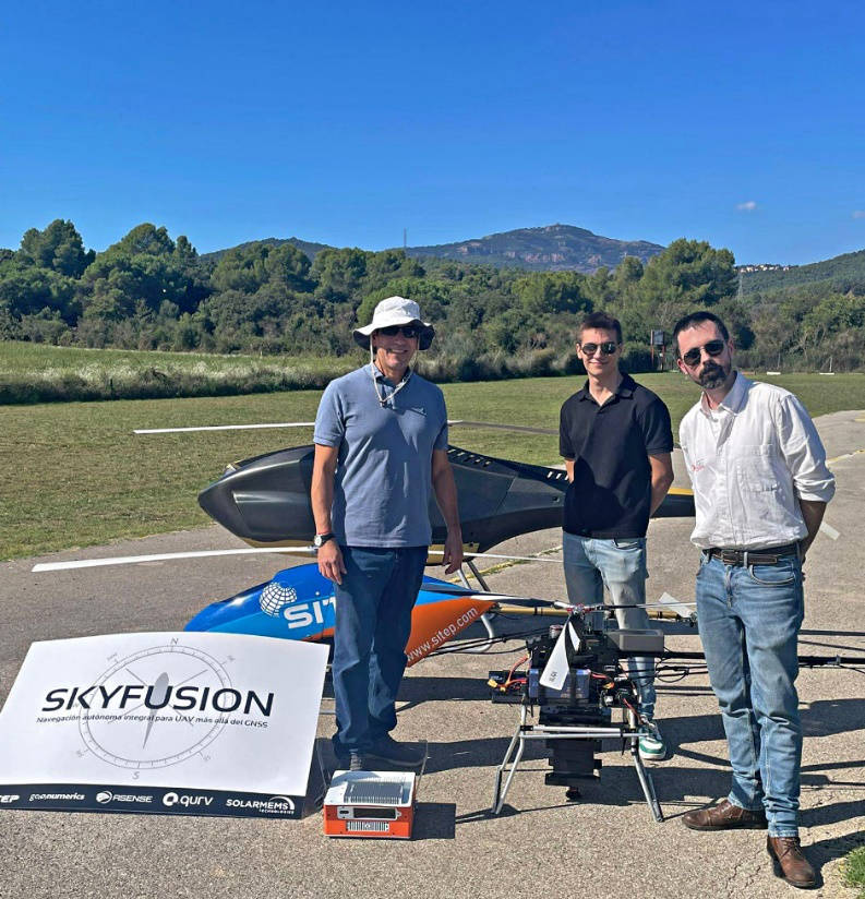
First flight tests:
The first Skyfusion test flights have recently been carried out, where the system has been tested in real conditions and the data collection from the integrated sensors has been verified.
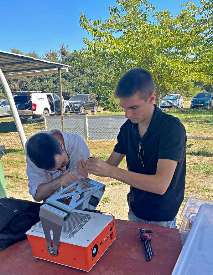
Our technical team participates in the preparation and adjustment of optical components during one of the test sessions.
Initial results confirm the robustness of the system and its ability to navigate and collect environmental information without the need for GPS.
Following these trials, the system will continue to be refined, incorporating improvements in navigation algorithms, component miniaturisation and validation on different UAV platforms. The next step is the integration of new artificial intelligence functions for even more advanced autonomous decision-making.
Consortium and collaboration
Skyfusion is made possible through the collaboration of leading companies in the fields of navigation, optics, computer vision, geospatial and photonics: SITEP, GEONUMERICS, QURV, ASENSE and SOLAR MEMS.
Thanks to our joint efforts, we are moving towards a new generation of UAV systems capable of operating with maximum autonomy and safety in all types of environments.
For more information about the project and future developments, please visit our page dedicated to the Skyfusion project.: https://www.asensenova.com/project/skyfusion/